22nd Annual Conservation Commission Gathering
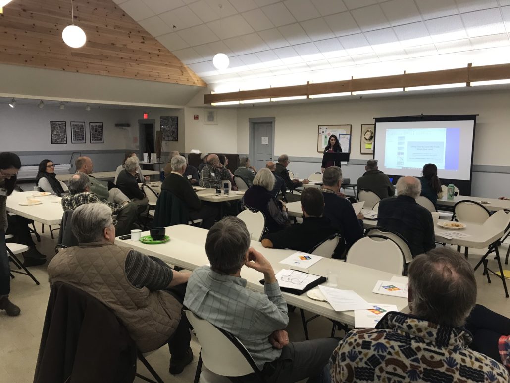
On March 5th, UVLT held our 22nd annual Conservation Commission Gathering at the United Methodist Church in Lebanon. We had twenty six participants from 14 towns across both states and one organization join us to spend the evening having dinner together, chatting with their fellow conservation commissioners, and learning about a mapping technique called LiDAR.
Megan Chapman, Conservation Project Manager, giving opening remarks.
After dinner, the speaking portion of the evening began with a welcome from UVLT’s Conservation Project Manager Megan Chapman, who highlighted some of the good work Upper Valley Conservation Commissions have accomplished this year. The wide variety of projects, activities, and goals of each commission highlights the diversity of our region and how conservation can be expressed and accomplished in so many exciting ways. These included:
- The Bradford Conservation Commission celebrated the 25th anniversary of the conservation of Wrights Mountain.
- The Charlestown Conservation Commission applied for and was awarded an Environmental Quality Incentives Program (EQIP) grant from NRCS for best management practices on town owned land.
- The Hanover Conservation Commission applied for and was awarded 125 special deer management antlerless permits which were distributed by lottery for hunting in the 3,800-acre special deer management area.
- The Hartland Conservation Commission developed and approved an emerald ash borer response plan for the town and continued to inventory ash trees along roads to understand the potential impact of EBA.
- The Orford Conservation Commission held not one but two public hearings to contribute funds to the Brackett Brook Farm conservation easement and helped with the local fundraising campaign.
- More than 200 people attended Thetfords 3rd annual Wildlife Film Festival featuring highlights from the Jackson Hole Film Festival.
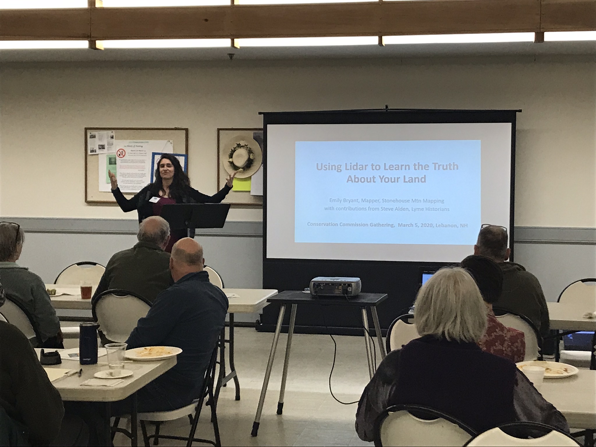
Emily Bryant, giving her presentation on LiDAR.
The speaker for the evening was Emily Bryant, a mapper and conservation commissioner from Orford, NH. Emily has an undergraduate degree in Math and spent her early years teaching math near Boston. She achieved “escape velocity” and moved to the Upper Valley where she got to put math and numbers to use looking at the earth. She worked for Dartmouth in the Earth Sciences Department for a number of years doing remote sensing: using computers (in the era of punch cards), and digital satellite images (in the ear of 9-track tapes) to map forests. She got a masters from Dartmouth in Computer and Information Science, and did heavy duty remote sensing at CRREL.
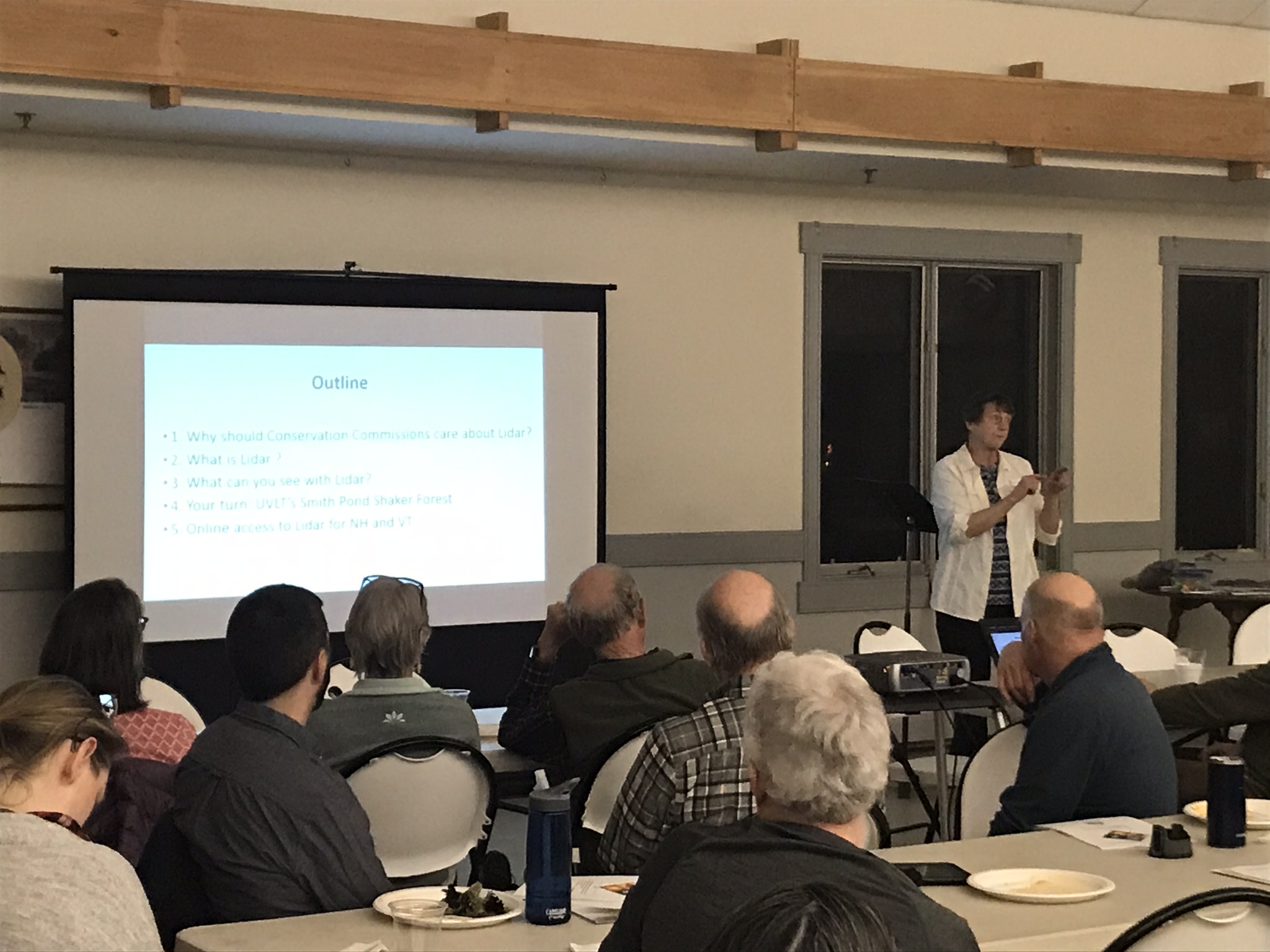
Emily’s presentation for the evening was called, “Using LiDAR to Learn the Truth About Your Land”. In the last decade, detailed elevation imagery called LiDAR has become available in both VT and NH. This technology can see through the blanket of the forest to the ground underneath, revealing features like stonewalls and cellar holes. It’s an incredibly useful addition to other online mapping resources. Emily described for the crowd how LiDAR works, and why its function might be both useful and important for conservation commissions and landowners alike.
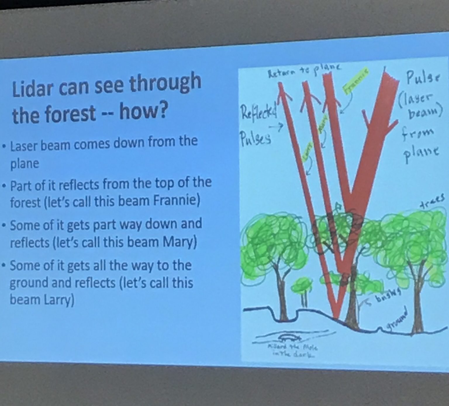
Lasers! Millard the Mole! It was an interactive presentation.
If you missed Emily’s enlightening presentation on LiDAR don’t worry! She will be presenting again at UVLT’s April Lunch & Learn event. April 16th from 12 – 1 pm at the Enfield Community Building.
A complication of Conservation Commission reports for 2019 can be found here.
Attending Commissions
Royalton, VT
Hartland, VT
Weathersfield, VT
Lebanon, NH
Grantham, NH
Norwich, VT
Plainfield, NH
Hartford, VT
Lyme, NH
Hanover, NH
Enfield, NH
Thetford, VT
Cornish, NH
Orford, NH
The New Hampshire Association of Conservation Commissions


