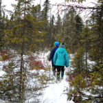
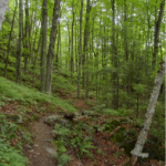
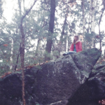
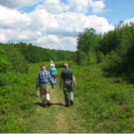
Places to Learn and Play
Ensuring public access to natural areas has always been a major priority of the Upper Valley Land Trust. Dozens of our projects, from Bath, New Hampshire, in the north to Unity, New Hampshire, in the south and all across Vermont, have included some provision for public access. These trails and other forms of access are now owned and managed by a variety of private landowners, town and regional commissions, neighborhood groups, UVLT staff and volunteers.
On the map at left, you can find many of the conserved lands where public access is guaranteed. Some have trails, while others are open for bushwhacking and exploring. To learn more about a specific site, scroll down below the map, where you can find a listing of all the trails. Links to maps, interpretive information, and other links are bold and clickable.
Before you go, don’t forget to read the Trail Use Guidelines we have posted here.
Want to receive email updates about all our latest trail openings and events? Click to button below to sign up for our monthly e-news!
Do you enjoy our trails and want to help us keep them in shape? Make a donation today to help us with trail maintenance.
UVLT Owned and Managed Conservation Areas
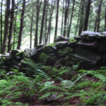
 Bear Pond Natural Area, Canaan, NH
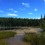
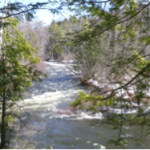
The Bear Pond area is one of UVLT’s largest projects by acreage, with over 900 acres including 95 acres of peat bog and 65 acres of wetlands at the headwaters of the Mascoma River. The bogs host a number of rare plant species and have been described as some of the best bogs in the state. The property also features a variety of other terrain, including 60-foot-tall rock outcrops, and is primarily covered in woodlands. Click for a Map.
 Brookmead Conservation Area, Norwich, VT
Brookmead Conservation Area is accessed from Turnpike Road. This property supports conservation stewardship and education, scientific research, agriculture and multi-use recreational trails. Enjoy the views of our rural countryside as you climb into the forest, or find quiet and solitude as you wander the miles of single track trails through the woods. The trails on this property connect with Norwich’s Parcel 5 trails, and the Blue Ribbon Connector trail. More information and trail map here.
 The Dismal at Pressey Brook, East Hanover, NH
The Dismal at Pressy Brook is a 213 acre forest and wetland complex in Hanover, NH generously donated to UVLT by Ann and Harte Crowe. The trails at The Dismal run on both sides of Goose Pond Road. Begin from the parking lot on the west side of Goose Pond Road and head west into a 2 mile network of looping forested trails suitable for hiking, biking, cross country skiing, and snowshoeing. On the east side of the road is a short, quarter mile loop trail with views of the expansive wetland from which the property gets its name “The Dismal” after the Great Dismal Swamp in Virginia and North Carolina. A trail map for the property can be found here.
 Ely Mountain Conservation Area, Thetford, VT
Located at the northern edge of Thetford’s largest unfragmented forest area, Ely Mountain is one of UVLT’s conservation ownerships. Acquired through a gift of Jock and Deecie Denison and supported by contributions from 90 local families and businesses and the Thetford Conservation Commission, this property is open to the public for hiking, snowshoeing and skiing. 187 acres were added in 2020. You will find huge old trees, rock outcroppings, glacial boulders, seeps and streams. Click for map and more information.
 Lyme Hill Conservation Area, Lyme, NH
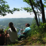
The Lyme Hill Conservation Area includes land owned by UVLT and abuts a number of parcels conserved by private landowners. Trails give recreationalists the chance to traverse from route 10 near the middle of town down to the Connecticut River itself, and affords views of the river valley and into Vermont. It has quickly become one of our most popular trail areas. Click for a Map.
 Linny Levin Trail and Zebedee Wetlands, Thetford, VT
Situated off of Houghton Hill Road in Thetford, the Zebedee Wetland was protected as a result of a huge community effort. It’s a favorite visiting spot for the Thetford Elementary School as well as many other area residents. The Linny Levin Trail traverses the wetlands and offers several spurs to vantage points over the beaver-maintained pond system. Click for a Map.
 Morey Mountain Conservation Area, Fairlee, VT
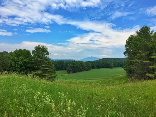
The Morey Mountain Conservation Area parking area can be accessed at 4707 Lake Morey Road, Fairlee, VT. Four miles of looping trails run through the majority of the property from the Lake Morey Road parking lot, up through the forest, and eventually connecting with the Palisades trail to a beautiful lookout over Route 5 and the Connecticut River.
The property lies near another UVLT-owned property – Cliff’s Cliff at the Palisades – and is within a larger area identified as a “hot spot” by the VT agency of Natural Resources due to an abundance of rare, endangered, or threatened species.The property includes portions of a Hemlock-Sphagnum Acidic Basin Swamp, a natural community considered rare in the State of Vermont, as well as vascular plants considered rare or extremely rare in the state. The eastern portion of the property buffers an active nesting area for peregrine falcons, making careful management of this area of critical importance to the success of the birds.
 Mountain View Farm, Orford, NH
This 146 acres property is a mix of forest, field and water that was once part of a group of successful farms in the 1800’s in a section of Orford known as Quinttown. The reclusive Billy Brown owned the property into with 1950’s with no electricity or running water and a road that wasn’t maintained through the winter. Visiting the property is like stepping back in time with no power lines or structures visible from the land’s 360 degree panoramic view. The property boasts a small cabin and historic barn, with a trail that goes through the farm fields to the shores of Mason Pond. Trail map here. Information about the conservation project here.
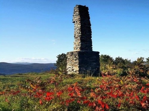 Pinnacle, Lyme, NH
A popular hiking and running spot, parts of the access to the Pinnacle in Lyme was conserved thanks to the generosity of two different landholders: Helen Darion and the Treadwell family. Years later, the 240 acres surrounding the already protected top of Pinnacle were conserved by Manning Rountree and Kendall Hoyt. The hilltop features an iconic abandoned chimney as well as views both across the Connecticut River into Vermont and to the Dartmouth Skiway, Smarts Mountain, and the rest of the White Mountains in New Hampshire. Directions: drive north on route 10 out of Lyme towards Orford, then turn right up Pinnacle Road once you have reached the end of Post Pond. After 2 miles, turn right on Highbridge Road. Continue over a bridge and up a steep hill. There will be a parking lot on your right. You can read more about the conservation project here and find a trail map here.
Please only use the parking lot on Highbridge Road for access to Pinnacle from this side. Please do not park on Cutting Hill Lane or along Pinnacle Road.
 Pegjack Memorial Forest, Thetford, VT
The Pegjack forest is part of a mosaic of forested land in Thetford and Fairlee and provides important habitat for mammals, raptors, and other wildlife. The site offers beautiful views over the Connecticut River valley. Although Pegjack does not have marked trails maintained by UVLT, there are plenty of paths through the woods and the land is available for public access and exploring. Access is from Turnpike Road in Thetford. Click for a Location and Features Map.
 The Robert Areson Conservation Area
The Robert Areson Conservation Area is 231 acres of forested upland in Norwich, VT that was generously donated to UVLT by the Areson family in honor of their father, who loved this land. There is an extensive trail network on the property that is well loved by neighborhood residents. The trails on this property are not blazed by UVLT and there is no map yet, but we encourage confident hikers to explore the trail network in the area, which also connects to the Appalachian Trail. Access to the trails is from Bragg Hill Road via Burton Woods Road, an unmaintained class four town road.
 Smith Pond Shaker Forest
Smith Pond Shaker Forest consists of 995 acres of forested land in Enfield located between two State Wildlife Management Areas. Together they total thousands of acres of wildlife habitat. There are two access points to the Smith Pond trail system. From 4a or from Smith Pond Road. The property boast two waterfalls, numerous articles from Shaker History including, spillways, dams, canals, and stone walls, and the beautiful Smith Pond with serene and scenic views. Access information and map of trails.
 Snow Mountain, Enfield, NH
Access and logging roads provide access into this 400-acre tract which spans Enfield, Grantham, and Plainfield. The multiple forest community types and four wetland complexes provide habitat to a huge variety of flora as well as wildlife like birds, bears, and beavers. There is no signage to direct hikers, but the area is open for exploration. To reach Snow Mountain, take Exit 15 off of I-89, and turn onto Old Route 10 going south. After a mile, just before the Upper Valley Humane Society, there is a pullout on the right. Park by the locked gate (but please DON’T block the road) and walk in. Click for a trail map.
 Tunis District Conservation Area, East Hanover, NH
Tunis District Conservation Area is 550 acres of wetland and forest complex along Wolfeboro Road in Hanover, NH. Access to the property is from a log landing on the south side of Wolfeboro Road. A 1/3 mile trail to an outlook can be reached from the road. There are currently no other marked trails on the property but there is a network of woods roads to be explored by the confident hiker.
 Up On the Hill Conservation Area, Charlestown, Unity NH
Up On the Hill Conservation Area was donated to UVLT by Chris and Harvey Hill in January 2017. This large forested property is actively used for agriculture and forestry and is open to the public for recreation. Blazed trails and trail maps are coming soon. Hunting is by permission only. Read about the land here. Trail map now available here.
Public Trails on Other UVLT Conserved Properties
 Balch Hill, Hanover, NH
One of the most popular recreation areas in Hanover, Balch Hill is located close to town and offers stunning views out over the Connecticut River Valley. UVLT conserved a 10-acre parcel belonging to Ralph and Betty Hunter which provides part of the access to the hilltop. The area is maintained by the Hanover Conservancy, which offers a website with a trail map and interpretive information.
 Bill Hill Trail, Thetford, VT
Bill Hill provides open hilltop views of the surrounding area. The short (approximately one half mile one-way) but relatively steep trail leads visitors past picturesque stonewalls and pastures, up the honeysuckle and raspberry-covered hillside, and to a peaceful spot to sit on a rock and take in the view from 800 feet up. Click for Trail Description or Map.
 Boltonville Nature Trail, Newbury, VT
The Boltonville Nature Trail is located on the Al-lens Farm, which features more than 60 acres of conservation land split between farmland and forest. This trail connects to the Cross Vermont Trail, and is maintained by the Cross Vermont Trail Association and the Newbury Conservation Commission. Click for a map of the area trails.
 Brushwood Community Forest, West Fairlee & Fairlee, VT
The Brushwood Forest is a large expanse of undeveloped forest land spanning several municipally-owned lots and multiple parcels of conserved land. The entire area stretches to 10,000 acres – but don’t worry, though you can explore as far as you want, there are shorter trails available too. One of the main parking areas for the forest is located on the UVLT-conserved Crawford parcel, which offers trail access into the forest. You can read about forest information and find a map on the West Fairlee webpage.
 Clay Brook Trail, Lyme, NH
A 3-mile trail north of the village of Lyme, Clay Brook offers a trip through multiple ecosystem types as well as a view of history, from the bottom of the postglacial Lake Hitchcock, along an old Abenaki road, and through the region’s agrarian past. The wetlands host a variety of bird life, including herons and kingbirds. Click for Trail Description or Map.
 Cobb Hill Trails, Hartland, VT
The Cobb Hill trails surround a working farm and co-housing community, which you are welcome to visit. The trails show every aspect of working land in the Upper Valley, from farm fields and pastures through sugarbush and managed forest. Ski trails are maintained in the winter. Click for Trail Description or Map.
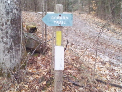
Coburn Trail, Strafford, VT
Considered among Vermont’s best-preserved historic villages, Strafford Village was one of the first sites in the state to be listed on the National Register of Historic Places. The ¼ mile-long Coburn Trail leads up a steep hillside to the top of the meadow, to a picnic table with a beautiful view overlooking the village and the Ompompanoosuc River Valley in which it lies. Click for Trail Description or Map.
 Colette Trail and Bicknell Loop Trail, Enfield, NH
The Colette Trail follows a portion of Bicknell Brook along its downstream course to Crystal Lake, connecting with the Bicknell Brook Trail Loop along the way. From cascading waterfalls to open beaver wetlands to climax forest to a lake environment, the Colette Trail offers a wide range of habitat diversity. Click for Trail Description or Map.
 Cossingham Road Farm Trails, Norwich, VT
In the heart of the Norwich countryside, the Cossingham Road trails back up to the Appalachian Trail, enabling many loops connecting trails with picturesque dirt roads, and also offer several kilometers of groomed skiing in the winter. You’re likely to run into livestock like Highland cattle, but if you venture into the wooded part of the property you can also find incredible natural features like vernal pools. Click for Trail Description or Map.
 Farnum Hill, Lebanon, NH
Seven miles of trails dot Farnum Hill, home of Poverty Lane Orchards and some of the most delicious apples and cider in the valley. Click for Trail Description and Map from the Lebanon Conservation Commission.
 French’s Ledges & Farnum Trails, Meriden, NH
The top of French’s Ledges offer panoramic views of the White Mountains. Trails range from longer loops to short, steep ascents, and three different trailheads provide access to this local treasure. While the area is surrounded by hundreds of undeveloped acres, you can also see evidence of historical activity, from cellar holes to an old ski tow. Click for Trail Description or Map.
 Grant Brook Trail & Big Rock Trail, Lyme, NH
Several trails follow Grant Brook along its path through Lyme. The lower trail traces the stream as it winds between farmland towards the river. The middle trail passes through the Big Rock nature area just of the back of the town common. The upper trail is situated in upland forest above the waterfalls which historically hosted a tannery. Click for Lower Trail Map, middle (Big Rock Trail) Map, or Upper Trail Map.
 Hazen Trail, Norwich & Wilder, VT
The mile and a half of trail from Norwich to Wilder connects to the Montshire Museum’s Ridge Trail and its popular planet walk. The path skirts the edge of farm fields and into the forest along the Connecticut River and includes sections through two different UVLT conserved farms. Click for a Trail Description or a Trail Map.
 Hughes Forest, Thetford, VT
Featuring hundreds of acres of woodlands, four beaver pond complexes, and some open fields, the Hughes Forest is a vast resource for Thetford residents. You’re likely to run into large mammals and a variety of bird life if you visit the property off of the Sawnee Bean road. It is maintained by the Thetford Conservation Commission, which provides a map of the forest.
 Leavitt Hill Wetland, Grantham, NH
This remote tract features 90 acres of wetland and forest habitat, as well as the remnants of a farming past with old stone walls and foundations. It’s accessed by the Class IV Leavitt Hill Road and is surrounded by other conserved lands and a Town Forest. There are no marked trails, but plenty of moose habitat to walk around in. To reach this property, take Exit 14 on I-89, then drive south on Old Route 10; after 2.5 miles turn right onto Miller Pond Road. The property is located about 1.5 miles along Leavitt Hill Road from a small pullout area just after Miller Pond Road crosses under the interstate. Click for a map of the property’s natural features.
 Lone Oak Trail, Bath, NH
The Lone Oak Trail is one of the steepest trails in the UVLT portfolio – but if you climb up to the height of land, you’ll be rewarded with spectacular views out over Vermont, New Hampshire, and three rivers: the Connecticut, the Wells, and the Ammonoosuc. The farmland and forests traversed by the trail belong to the Lackie Farm, UVLT’s northernmost project. The trailhead is located on Abbot Avenue just north of Woodsville. Click for a Location and Trail Map.
 Mill Road Floodplain Preserve, Lebanon, NH
The Mill Road preserve features wetlands, forest, and riparian habitats along the Mascoma River. Access comes from the discontinued Mill Road, which continues into the site; because of flooding, no formal trails have been built. However, there are plenty of small footpaths to explore along the river, and it’s also adjacent to the Northern Rail Trail. To access this property, take Exit 17 off of I-89 and onto Route 4 East for a bit over a mile. Just before the road crosses over the Mascoma River, turn left onto Mill Road. Park at the gate and walk in. Click for a location map.
 Milton Frye Nature Area Trails, Norwich, VT
The Milton Frye Nature Area comprises nearly 35 acres behind the Marion Cross Elementary School in Norwich, offering easy access to nature from just within the village. It is managed by a community board and also hosts all sorts of activities for kids and adults. Click for a map and the Milton Frye Nature Area Committee’s website.
 Moulton Trail & Cole Brook Trail, Meriden, NH
The Moulton trail was made for birders: it connects the Helen Woodruff Smith Bird Sanctuary with the town-owned Benson Lot. But it’s also a wonderful 1.5-mile wander for hikers, skiers, and snowshoers. The Cole Brook Trail continues into the Benson Lot and can make a loop to Cram Hill Road. Directions can be found using Plainfield’s interactive natural resources map.
 My Walden, Sharon, VT
A network of well-maintained roads and trails enable visitors to traverse most all the property on foot or skies/snowshoes. Wheeled and motorized vehicles (e.g. bikes, trucks, snow-mobiles) and horses are not permitted. Visitors can enjoy the beauty of nature close-up, by one of the waterfalls, for example, or far off, looking at distant mountains atop of the open meadows or fields. Click for a Map.
 Paradise Park & Lake Runnemede, Windsor, VT
Lake Runnemede is a unique body of water body: so pure and alkaline that it hosts a species of pondweed only found in six lakes in the entire country. Surrounded by beautiful forest, the lake has been appreciated by generations of Windsor residents. UVLT helped conserve part of the area that now comprises the town’s Paradise Park. You can find a trail map on their website.
 Post Mills Natural Area, Thetford, VT
100 acres once slated for a landfill, the Post Mills Natural area now provides summer and winter recreation opportunities for area residents. The area featured multiple forest types as well as frontage on the Lake Fairlee outlet. It is maintained by the Thetford Conservation Commission, where you can find a map of the trails and paths.
 Rikert Broad Brook Trail & Veterans Memorial, Sharon & South Royalton, VT
This Trail is Closed Until Further Notice.
The Rikert Trail can be hiked in the summer and skied or snowshoed in the winter, and traverses gradual terrain along Broad Brook. It’s a memorial to Hugh Rikert, a World War II veteran who purchased the parcel when he finished his service. Rikert, who passed away in 2000, wanted to share the serenity of this corner of Vermont with fellow veterans. The Rikert Trail was his way of doing so. Click for Trail Description or Map.
 Sally Drew Trail, Vershire, VT
This trail to the top of Patterson Mountain is named for Sally Drew, who found a way to purchase a large tract of land and conserve it in 1991. Drew then donated the top of the mountain to the town of Vershire, and sold the rest of the property. The trail that bears her name provides an opportunity to see natural forest succession in action, in addition to beautiful views over eastern Vermont. It has since been incorporated into the Cross Rivendell Trail. You can explore the area and find directions using the Cross Rivendell Trail online interactive map.
 Shea Town Forest, Corinth, VT
A parcel of woods nestled between Cookeville and the Washington-Corinth Highlands and adjacent to other UVLT-conserved land, the Shea Town Forest provides trail access through a forest that has been increasingly posted as private. It is managed by the Corinth Town Forest Committee and an active and dedicated group of community members, who also maintain a Shea Forest page with directions to the forest and a map.
 Signal Hill, Lebanon, NH
Beautiful overlooks from old logging roads and views of Croydon Mountain, Mount Ascutney and Blueberry Hill. UVLT helped the City of Lebanon acquire and conserve this land which got its name because it was once part of the old chain of signal hills and mountains that date back to the Revolutionary War days when signal fires were lit atop the hills to indicate that the Redcoats were coming. The City posts a map, directions and more information.
 Slade Brook & Jim and Evalyn Hornig Natural Area, Hanover, NH
A quiet piece of property in the Hanover Forest, Slade Brook offers access to myriad different natural habitats along the beautiful Waterfall Trail. It is maintained by the Hanover Conservancy in honor of its longtime leader “and a dedicated UVLT partner” Jim Hornig, and his wife Evalyn. Find out more about the area, including a trail map, at the Hanover Conservancy’s Slade Brook page.
 Sleepers Meadow Trails, Newbury, VT
The Sleepers Meadow Trails in Newbury start off in a historic farmstead, but soon draw hikers, bikers, snowshoers, and skiers into quiet forests. One striking feature is a large field which provides views over the Connecticut River into New Hampshire. Click for Trail Description or Map.
 Starr Hill, Lebanon, NH
Starr Hill provides a comfortable spot of nature close to several of Lebanon’s most populated areas. It was conserved and donated to the City of Lebanon through the generosity of Sid and Laurel Letter, who took out a second mortgage on their home in order to purchase the property and ensure that it has public access forever. You can read more about this remarkable act here, and find a map of the area thanks to the Lebanon Conservation Commission.
 Thurber Memorial Forest, Unity, NH
A large tract of forest in the east corner of Unity, the Thurber property was conserved in memory of Ina and Nathaniel Thurber by their daughter Laura Ryan – and in fact, the family owned the land since first arriving in Unity in the mid-1700’s. That history is visible in the stone walls and foundations that lie scattered in the woods. The parcel now boasts a wonderful trail network and convenient parking access. Access is at 400 Lear Hill Road in Newport.
 Trout Pond Trail, Lyme, NH
Trout Pond was one of the UVLT’s earliest big projects, and after it was conserved it was donated to the town of Lyme. You can now visit a mild three-quarter mile trail that takes walkers and snowshoers from a class IV road to the picturesque and perfectly quiet pond below Smarts Mountain. The south side of the pond is home to a rich wetland complex, while the forest is equally fun to explore. Click for Trail Description or Map.
 True’s Ledges Trails, Lebanon, NH
True’s Ledges are a popular swimming hole along along a rocky gorge where True’s Brook loses some serious elevation. Protected in 1998, UVLT maintains a third of a mile of easy, but somewhat hazardous trail to reach the gorge. Click for Trail Description and Map.
 Two Rivers Conservation Area, Lebanon, NH
Once the site of sand and gravel mining, this land at the confluence of the Mascoma and Connecticut Rivers is a rebounding natural area with floodplain forest and wetland. UVLT acquired the land and transferred it to the City of Lebanon in 1990. Click for More information and Map.
 Upwey Farm Trail, South Woodstock, VT
When UVLT protected the Upwey Farm Trails, we were conserving a favorite spot for horseback riders and snowmobilers, not just walkers. The trail begins along a gravel farm road and winds through the forest. This trail is jointly managed by the Green Mountain Horse Association and the Vermont Association of Snow Travelers (VAST). Click for a Map.
 Windsor & Weathersfield Trails on Mt. Ascutney, Windsor & Weathersfield, VT
Mount Ascutney, the highest peak in Windsor County at 3,130 feet, has lured area hikers for years. In 2000, UVLT protected a 300-acre parcel in Windsor which included one of the main trails to access the summit. This is part of an ongoing effort to preserve all hiking access to Ascutney for the future, including the Weathersfield Trail. A map of all the trails on Ascutney can be found thanks to the State Park website
 Wright’s Mountain Trail, Bradford, VT
A variety of trails are scattered around the Wright’s Mountain area of Bradford. There’s access from three different parking areas and hiking opportunities include both a lookout from high atop the mountain to the Devil’s Den area, a favorite haunt of local recreationalists and nature enthusiasts. These trails are maintained by the Bradford Conservation Commission. Click for Trail Description and Map.
Check Out Our Blog
 https://uvlt.org/wp-content/uploads/2024/07/Will-Sheff-e1720439487550.jpeg
256
493
Jeanie McIntyre
http://uvlt.org/wp-content/uploads/2021/09/uvlt-logo-stacked.png
Jeanie McIntyre2024-07-08 19:24:272024-07-08 19:24:27Okkervil River to Return to their Upper Valley Roots
https://uvlt.org/wp-content/uploads/2024/07/Will-Sheff-e1720439487550.jpeg
256
493
Jeanie McIntyre
http://uvlt.org/wp-content/uploads/2021/09/uvlt-logo-stacked.png
Jeanie McIntyre2024-07-08 19:24:272024-07-08 19:24:27Okkervil River to Return to their Upper Valley Roots https://uvlt.org/wp-content/uploads/2024/07/Tunis-Brook-Frontage-Cropped-scaled.jpg
1168
2560
Jeanie McIntyre
http://uvlt.org/wp-content/uploads/2021/09/uvlt-logo-stacked.png
Jeanie McIntyre2024-07-08 19:23:072024-07-08 19:23:07Resilient Connections at Rocky Knoll
https://uvlt.org/wp-content/uploads/2024/07/Tunis-Brook-Frontage-Cropped-scaled.jpg
1168
2560
Jeanie McIntyre
http://uvlt.org/wp-content/uploads/2021/09/uvlt-logo-stacked.png
Jeanie McIntyre2024-07-08 19:23:072024-07-08 19:23:07Resilient Connections at Rocky Knoll https://uvlt.org/wp-content/uploads/2024/07/DSCN0815.jpg
1704
2272
Jeanie McIntyre
http://uvlt.org/wp-content/uploads/2021/09/uvlt-logo-stacked.png
Jeanie McIntyre2024-07-08 19:06:492024-07-08 19:06:49Lyme Pinnacle Conservation Area Grows
https://uvlt.org/wp-content/uploads/2024/07/DSCN0815.jpg
1704
2272
Jeanie McIntyre
http://uvlt.org/wp-content/uploads/2021/09/uvlt-logo-stacked.png
Jeanie McIntyre2024-07-08 19:06:492024-07-08 19:06:49Lyme Pinnacle Conservation Area Grows